
Use CGI renders when visuals will materially affect a planning officer’s or committee’s understanding of scale, context, and impact. For major schemes, heritage settings, and outline proposals where massing needs clarifying, they are not optional extras — they are the difference between a clear submission and a protracted validation query. For a modest householder extension in a straightforward setting, a well-drawn elevation may suffice.
Three things to do now:
- Check your LPA’s local validation list. Tower Hamlets’ CGI guidance, for example, requires CGI visualisations for major developments and specifies that views and format are determined through pre-application discussions. Your authority may have equivalent requirements.
- Decide whether you need verified views. If the submission will be tested against visual impact — heritage, townscape, or landscape — you need survey-accurate camera positions and a verification statement, not just illustrative renders.
- Gather your survey coordinates before briefing a studio. Without OS-referenced coordinates and topographic survey data, a CGI supplier cannot produce planning-grade outputs.
One labelling point that catches teams out: any visual submitted with an outline planning application must be explicitly marked as illustrative. If it is not, the LPA may treat it as forming part of the application, which can inadvertently fix details that were meant to remain as reserved matters.
Table of Contents
- Why planning-grade CGI helps secure permission in the UK
- What local planning authorities expect from planning-grade visuals
- What types of CGI are used in planning applications?
- How are verified views and photomontages produced?
- How to brief a CGI supplier for a planning submission
- What do planning-grade CGI renders cost in the UK?
- How to include CGI renders in your planning submission
- How do you choose the right CGI provider for planning work?
- What do good planning visuals actually look like?
- Key takeaways
- The gap between a pretty render and a planning document
- Visualtrick’s planning CGI services: get a quote
- Useful sources and further reading
Why planning-grade CGI helps secure permission in the UK
Clear, accurate visuals reduce uncertainty about massing, materials, and impact. That matters because planning officers are assessing proposals against policy, often under time pressure, and a well-constructed CGI removes the interpretive guesswork that generates queries, objections, and revision cycles.
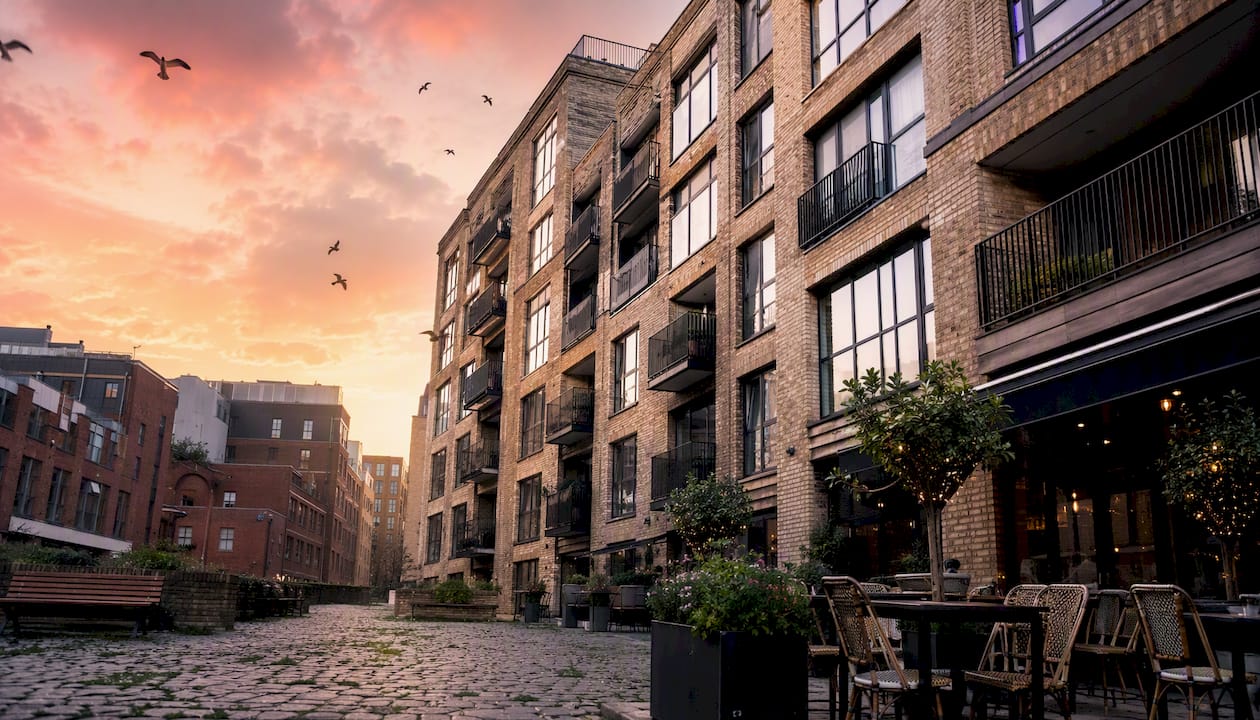
Consider a major urban residential scheme in a dense city context. Without a street-level verified view showing the proposed building alongside its neighbours at the correct scale, an officer cannot confidently assess whether the height is acceptable or whether the massing overwhelms the street. A photomontage produced from a surveyed camera position answers that question directly, in a way that a floor plan and elevation simply cannot.
Heritage settings raise the stakes further. A proposal adjacent to a listed building or within a conservation area will almost always require visuals that show the relationship between old and new fabric. Officers and Historic England consultees need to see materials, fenestration rhythm, and roofline in context — not described in a design statement, but shown. CGI produced to the correct standard gives them that.
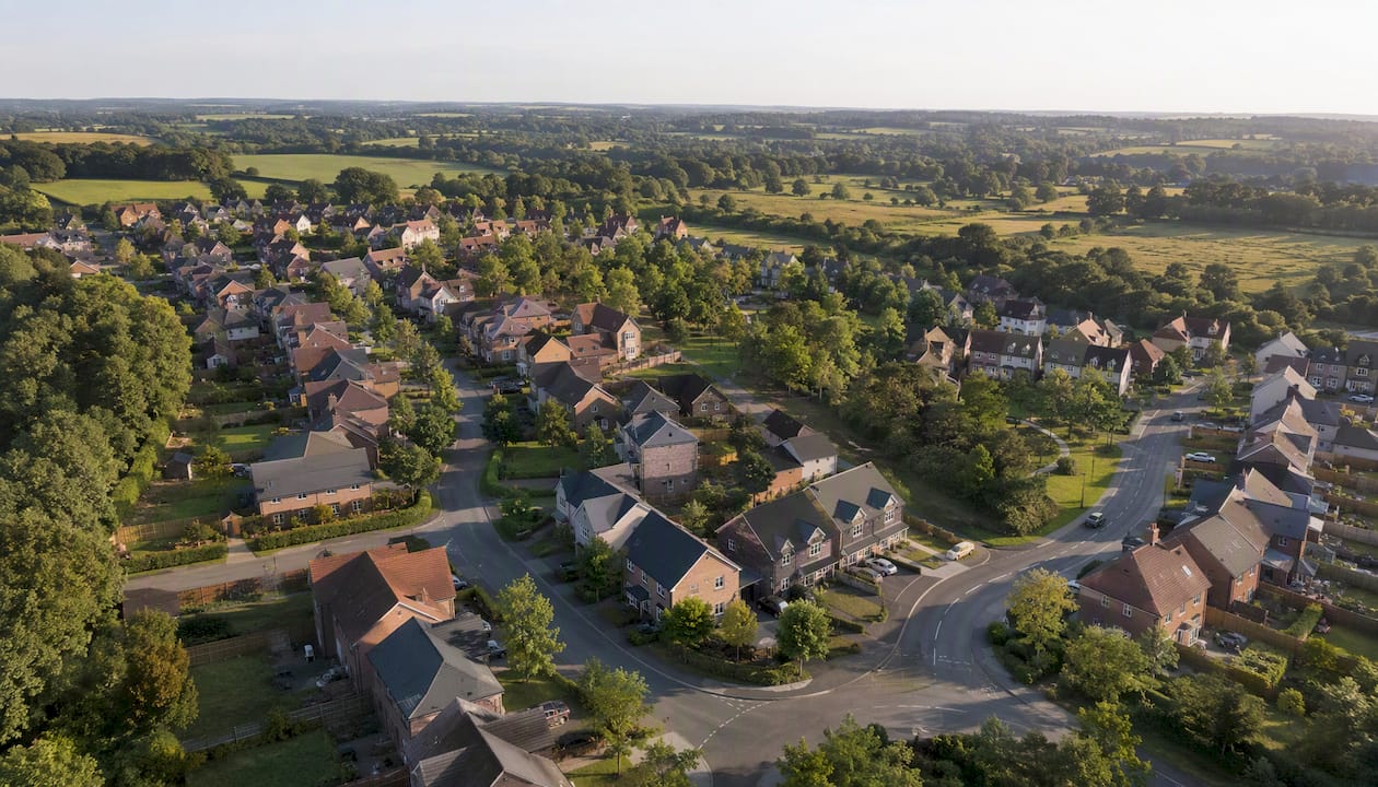
Suburban massing disputes are a third scenario where renders earn their fee. Where neighbours object on the grounds of bulk or overbearing impact, a photomontage from a surveyed viewpoint at the boundary provides an objective reference that committee members can assess rather than argue about. The role of visuals in planning permission is precisely this: to replace contested description with verifiable representation.
The planning outcome benefits are concrete. Officers sign off more quickly when they are not chasing clarification. Committees make faster decisions when they can see what is proposed. Public consultation responses are more focused when residents are looking at an accurate image rather than imagining from a written description.
What local planning authorities expect from planning-grade visuals
Officers are looking for accuracy, context, verified viewpoint provenance, correct scale, and honest representation of materials. Anything that obscures those qualities — flattering lighting that hides bulk, camera positions that minimise height, or materials rendered more sympathetically than specified — is likely to generate a query or, worse, an objection at committee.
The checks officers typically run, in order:
- Site survey match. Does the ground level, topography, and surrounding built form in the image correspond to the actual site survey?
- Camera position provenance. Is the camera location documented with OS grid reference and coordinates? Can it be independently verified?
- Horizon and ground reference. Are horizon lines consistent between the CGI and any photographic base? Is the ground plane correctly established?
- Scale references. Are annotated scale bars, human figures at correct height, or known reference buildings included to allow visual scale-checking?
- Lighting consistency. Does the lighting direction and quality in the CGI match the photographic base (for photomontages) or represent a realistic condition?
- Materials accuracy. Do the materials shown correspond to those specified in the application? Placeholder or generic textures are a common red flag.
- Metadata and labelling. Does each image carry its status (verified/illustrative), the viewpoint reference number, the date, and the file name?
Planning authorities need accurate visuals precisely because these checks are the mechanism by which officers satisfy themselves that a proposal is as described. A submission that fails two or three of these points will generate a validation query at best and a refusal reason at worst.
Pro Tip: Include the OS grid reference and camera coordinates directly on the face of each image — not just in the verification statement. Officers reviewing a large submission bundle often look at images before they locate the statement, and a coordinate label on the image itself prevents the two from becoming separated.
What types of CGI are used in planning applications?
Different image types serve different planning purposes. Choosing the wrong type wastes budget and can leave gaps in the evidence base that officers flag at validation.
Street-level verified views
A camera is positioned at a surveyed location, its coordinates recorded, and the proposed building is composited into a photograph of the existing scene at the correct scale and perspective. This is the standard output for townscape and heritage impact assessments. Use it when the submission needs to demonstrate how a building reads from a public viewpoint — a street corner, a park, a river crossing.
Verified photomontages
Technically the same process as a verified view, but the term is often used specifically when the image is submitted as formal evidence of visual impact rather than as an illustrative aid. The distinction matters for labelling: a photomontage submitted as evidence carries a verification statement; an illustrative view does not, and should be labelled accordingly.
Aerial and masterplan views
Rendered from above, these show site layout, massing relationships, and landscape context. They are particularly useful for outline applications where the principle of development is being tested and the LPA needs to understand the overall disposition of buildings, open space, and access. A simple massing model rendered from above is often sufficient at this stage — photorealism is not required when the question is about layout and scale rather than appearance.
Massing diagrams
Wire-frame or block models that show height, footprint, and volume without materials or detail. These are appropriate early in the process, at pre-application stage, or when the reserved matters include appearance. They are also useful for committee presentations where the question is purely about bulk.
Material and detail studies
Close-up renders showing proposed materials, fenestration, and surface treatments. These support design and access statements and are particularly valuable in conservation areas where the LPA needs to assess whether proposed materials are appropriate. A CGI for interior designers approach applies here too, where internal communal spaces or amenity areas form part of the planning case.
A simple massing model is enough when the LPA’s question is about scale and disposition. Photorealism becomes necessary when the question is about appearance, materials, or visual impact on a sensitive setting.
How are verified views and photomontages produced?
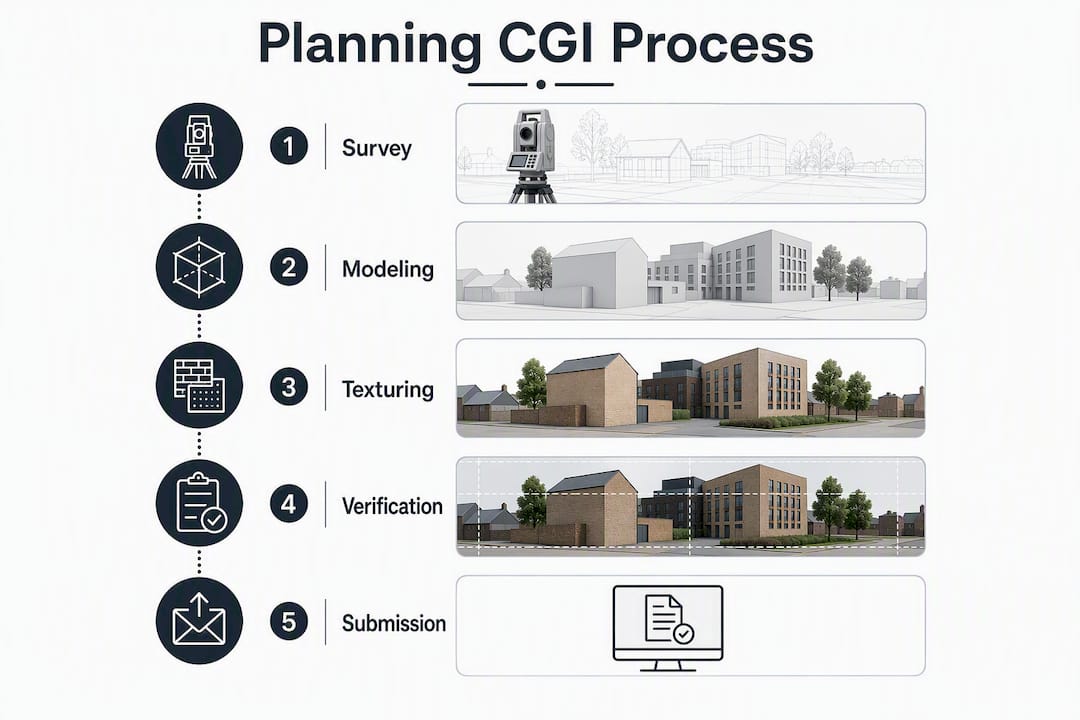
Verified views require survey-accurate camera positions, OS-referenced coordinates, and a verification statement. The production process has six distinct steps, and skipping any one of them undermines the credibility of the output.
- Topographic and site survey. A licensed surveyor captures ground levels, existing built form, and control points across the site and surrounding area. This data forms the geometric foundation for everything that follows.
- Camera position capture. A surveyor records the precise location of each agreed viewpoint using total station or GNSS equipment, producing OS National Grid coordinates accurate to within a few centimetres.
- Model alignment. The 3D model of the proposed development is geo-referenced against the OS/topo survey data. The model’s ground plane, orientation, and scale are locked to the survey before any rendering begins.
- Rendering. The model is rendered from the surveyed camera position using the correct lens focal length (typically 50mm equivalent for human-eye views), matching the photographic base image.
- Photomontage composition. The rendered image is composited with the base photograph, with careful attention to lighting, colour grading, and edge treatment to produce a seamless and honest result.
- Verification statement. The studio produces a written statement confirming the methodology, listing the camera coordinates, OS grid reference, survey date, surveyor credits, and file names for each viewpoint.
The verification statement checklist a studio should supply includes: camera coordinates (easting, northing, elevation), OS National Grid reference, date of survey and photography, surveyor name and company, lens focal length and camera model, file names for base photograph and final composite, and a brief methodology note.
Ordnance Survey data and licensed topo survey or LiDAR are the primary data sources for this work. Studios using OS data must hold the appropriate licence — typically an OS OpenData or OS MasterMap licence depending on the level of detail required. Check that your supplier can confirm their licensing position before commissioning.
Pro Tip: Ask the studio to retain the raw scene files, camera rigs, and survey data after delivery. If the application goes to appeal, or if the LPA requests revised viewpoints, having the original geo-referenced scene means revisions take hours rather than days and the methodology chain remains unbroken.
The planning-grade visual documents standard sets out the minimum evidence a studio should supply. If a supplier cannot produce a verification statement that meets this standard, their outputs will not withstand scrutiny at committee or appeal.
How to brief a CGI supplier for a planning submission
Give the studio survey coordinates, topographic survey drawings, the proposed massing model, and a short design narrative. Without those four inputs, no studio can produce planning-grade outputs — and any that claim they can without survey data are producing illustrative images, not verified views.
Questions to ask a supplier before commissioning:
- What is your experience with LPA submissions, and can you name authorities you have worked with?
- Do you produce a verification statement, and can you share an example?
- How do you geo-reference your models — do you use OS/topo survey data or photogrammetry?
- What OS data licences do you hold?
- What is your revision policy if the LPA requests additional viewpoints after submission?
- What is your typical turnaround from receipt of survey data to delivery of final images?
Deliverables table
| Image type | Resolution / size | Annotated viewpoints | Raw scene files | Verification statement | File formats |
|---|---|---|---|---|---|
| Verified view | Min. A3 (print); long edge (digital) | Yes — viewpoint ref, coordinates, north point | Retained by studio | Required | TIFF/PDF + JPEG |
| Verified photomontage | Min. A3 | Yes — as above plus base photo ref | Retained by studio | Required | TIFF/PDF + JPEG |
| Aerial/masterplan view | A2 recommended | Site boundary, scale bar, north point | Retained by studio | Recommended | TIFF/PDF + JPEG |
| Massing diagram | A3 | Scale bar, height annotations | Retained by studio | Not required | PDF + JPEG |
| Material/detail study | A3 | Material specification labels | Retained by studio | Not required | TIFF/PDF + JPEG |
For architects briefing planning visuals, Visualtrick’s CGI for architects service page sets out the typical workflow and what the studio needs from the design team at each stage.
What do planning-grade CGI renders cost in the UK?
Provide a low, typical, and high price band in your programme plan — then adjust based on the factors below. The main cost drivers are the level of photorealism required, the number of verified views, modelling complexity, and whether you need to procure a topo survey separately.
Price and turnaround guide
| Complexity | Typical fee range | Turnaround |
|---|---|---|
| Simple massing model (1–2 views, no photomontage) | £800+ | 5 working days |
| Mid-range planning CGI (2–4 verified views, photomontage) | £2,500+ | 10 working days |
| Complex scheme (5+ verified views, heritage/townscape assessment) | £7,000+ | 4 weeks |
These ranges reflect typical UK studio fees and do not include the cost of a topographic survey, which is procured separately and typically adds £1,500–£5,000 depending on site size and complexity.
When to commission relative to key programme dates
- Pre-application stage: Commission massing models and indicative views for pre-app discussions with the LPA. This is also when to agree viewpoints.
- Four to six weeks before submission: Brief the studio on verified views. Allow time for survey procurement, model alignment, and at least one round of client review.
- Two weeks before committee: Deliver final print-ready boards and digital files to the planning consultant. Allow time for officer pre-briefing.
- After LPA feedback: If the officer requests additional viewpoints or revised materials, the studio should be able to turn these around within five to ten working days from a retained scene file.
How to include CGI renders in your planning submission
Label every visual with its status — verified or illustrative — provide metadata on the image face, and include the verification statement as a standalone document within the submission bundle. That is the baseline. Everything else is presentation.
Step-by-step inclusion process:
- File naming. Use a consistent convention:
[ProjectRef]_[ViewpointRef]_[ImageType]_[Date].[ext]— for example,ABC123_VP01_VerifiedView_2026-03.tif. This allows officers to cross-reference images against the verification statement without confusion. - Submission bundle placement. Place CGI images within the Design and Access Statement or as a standalone Visual Impact Assessment, depending on the LPA’s preference. Never scatter images across multiple documents without a master index.
- Embedding in the Design and Access Statement. Each image should appear at the point in the narrative where it is referenced, with a caption that includes the viewpoint reference, status, and date. Do not rely on the reader locating a separate appendix.
- Verification statement. Append the verification statement as a separate document, clearly titled and cross-referenced to the image file names. Some LPAs require it as a standalone submission document rather than an appendix.
- Labelling format on images. Each image should carry, in a consistent footer or title block: project name, viewpoint reference, image status (e.g. Verified View or Illustrative — not a reserved matter), camera coordinates, date, and studio name.
For outline planning applications, the labelling of illustrative material is a legal point, not just a presentation convention. Under Section 92 of the Town and Country Planning Act 1990 and the associated PPG, details submitted with an outline application may be treated as part of the development unless explicitly stated otherwise. Every illustrative image must carry the words illustrative only — not a reserved matter or equivalent wording agreed with the LPA.
At committee, present visuals on A1 printed boards and in a slide deck. Brief the officer in advance — officers who have already reviewed the images are far more effective advocates at committee than those encountering them for the first time in the chamber. Visualtrick’s guide to presenting planning arguments visually covers viewpoint selection and committee presentation in detail.
How do you choose the right CGI provider for planning work?
Choose a supplier with proven planning experience and a verifiable methodology. Portfolio images alone are not sufficient evidence of planning competence — a studio that produces beautiful renders for marketing may have no experience of verified-view methodology, OS data licensing, or verification statements.
Selection checklist:
- Confirmed experience submitting CGI to LPAs, with named authorities or application references
- Ability to produce verified views with a full verification statement
- Confirmed use of OS/topo survey or LiDAR data for geo-referencing
- Clear deliverables list covering image resolution, annotated viewpoints, raw scene files, and file formats
- Stated revision policy and turnaround times
- References or portfolio examples from planning submissions (not just marketing campaigns)
Sample tender questions:
- Can you provide examples of verified views submitted to a local planning authority?
- What is your geo-referencing workflow, and which OS data products do you use?
- Who conducts the survey — do you work with a licensed surveyor, or do you expect the client to provide survey data?
- What does your verification statement include, and can you share a template?
- What happens if the LPA requests additional viewpoints after submission?
Red flags to watch for:
- No verification statement offered, or unfamiliarity with the term
- Refusal to share camera metadata or coordinate data
- Inconsistent file naming across a portfolio
- No mention of survey data — models built from Google Maps or photogrammetry alone are not planning-grade
- Pricing that seems very low for verified views (a sign that the methodology is being skipped)
What do good planning visuals actually look like?
Good visuals are accurate, contextual, annotated, and reproducible. The test is simple: could another studio, given the same survey data and camera coordinates, produce a substantially similar image? If yes, the methodology is sound. If the image depends on undocumented choices, it will not withstand scrutiny.
Quick-check criteria:
- Scale and context: Known reference buildings or human figures at correct height are visible; the proposed building reads at the right scale relative to its neighbours.
- Horizon and ground reference: The horizon line in the CGI matches the photographic base; the ground plane is correctly established and consistent across the image.
- Lighting consistency: Lighting direction, shadow angle, and sky condition in the rendered element match the base photograph.
- Materials accuracy: Specified materials are shown, not generic placeholders. Brick coursing, window proportions, and surface texture correspond to the specification.
- Metadata and annotation: Viewpoint reference, coordinates, status label, and date appear on the image face.
Before and after: two common improvements
A massing block model submitted without annotation or scale reference becomes planning-grade when it carries a scale bar, height annotations in metres, a north point, and a note confirming the model is geo-referenced to OS survey data. The image itself may look similar — the difference is in what the officer can verify from it.
An illustrative street-level render produced from a non-surveyed camera position becomes a verified view when the camera is repositioned to a surveyed point, the coordinates are recorded, the model is aligned to topo survey data, and a verification statement is appended. The visual difference may be subtle; the evidential difference is substantial.
Key takeaways
Planning-grade CGI requires survey-accurate camera positions, OS-referenced coordinates, a verification statement, and correct labelling — without all four, visuals risk generating validation queries or being treated as reserved matters in outline applications.
| Point | Details |
|---|---|
| Check LPA guidance early | Review your authority’s local validation list before briefing a studio — requirements vary significantly between LPAs. |
| Demand verified views when needed | Any submission tested against visual impact requires surveyed camera positions, OS coordinates, and a verification statement. |
| Label illustrative material correctly | Outline application visuals must be marked illustrative only to avoid unintentionally fixing reserved matters. |
| Brief with survey data | Give the studio topographic survey drawings and OS-referenced coordinates before commissioning — without them, planning-grade outputs are not possible. |
| Visualtrick for planning CGI | Visualtrick delivers verified views, photomontages, and planning-grade visuals with verification statements and OS-referenced methodology for UK submissions. |
The gap between a pretty render and a planning document
There is a version of this conversation that happens on almost every major scheme: the developer has commissioned beautiful CGI for the marketing brochure, the planning consultant asks whether those images can go into the submission, and the answer is almost always no. Marketing renders are produced from flattering camera angles, with idealised lighting and materials that may not match the specification. They are not geo-referenced. They carry no verification statement. Submitting them as planning evidence is not just methodologically weak — it can actively undermine a case if an officer or inspector concludes the images were chosen to present the scheme in its best light rather than its accurate one.
The more interesting observation is that the gap between a marketing render and a planning-grade verified view is not as large as studios sometimes suggest. The core 3D model is often the same. What changes is the camera position (surveyed rather than chosen for composition), the methodology (documented rather than intuitive), and the deliverables (verification statement, annotated viewpoints, retained scene files). A studio that builds planning methodology into its workflow from the start can produce both outputs from the same model — which is why commissioning planning-grade CGI early, before the marketing campaign, is almost always the more efficient route.
Visualtrick’s planning work is built on exactly this principle: the same model that supports the planning submission can be extended for marketing once permission is granted, without starting again.
Visualtrick’s planning CGI services: get a quote
Visualtrick produces planning-grade CGI for UK developers, architects, and planning consultants — verified views, photomontages, aerial masterplan renders, massing diagrams, and material studies, all delivered with verification statements and OS-referenced methodology.

Every planning submission package includes annotated viewpoints, a verification statement with camera coordinates and OS grid references, retained raw scene files, and print-ready files at the resolution your LPA requires. For architects working through the planning process, the CGI for architects service covers the full workflow from pre-application massing through to committee presentation boards.
To request a quote or discuss pre-application support, contact Visualtrick directly. When you get in touch, ask specifically about verification statements and OS-referenced deliverables — those two things tell you immediately whether a studio is equipped for planning work.
Useful sources and further reading
- CGI Visualisations — Tower Hamlets Local Planning Authority: The Tower Hamlets local validation list entry for CGI, useful as a concrete example of what an LPA requires and how views and format are determined through pre-application discussions.
- LexisNexis: outline applications and parameter plans marked as illustrative: Legal grounding for the reserved-matters labelling point, referencing Section 92 TCPA 1990 and PPG
- Design guidance — GOV.UK: The government’s national design guidance, including references to the role of visual evidence in planning submissions.
- What are planning-grade visual documents? — Visualtrick: Defines the minimum verification evidence a studio should supply and sets out what planning-grade documentation looks like in practice.
- Planning Visuals — Visualtrick: Visualtrick’s dedicated planning visuals service page, covering deliverables, verification practices, and sample outputs for planning submissions.
