
A verified view for London planning is a photomontage or Accurate Visual Representation (AVR) produced from surveyed camera positions, calibrated photography and precise 3D modelling, built to withstand scrutiny from a Greater London Authority or borough planning officer. To pass muster, the work needs to align with the London View Management Framework and the Landscape Institute’s guidance on visualisation as technical evidence, not marketing polish. If you’re preparing an application that touches a protected vista, a tall building policy area, or a sensitive skyline, the sensible next step is to request a planning-ready quote from a supplier who can demonstrate LVMF experience before you commit to a design freeze.
Key Takeaways
Planning-ready verified views for London require documented survey control, LVMF and Landscape Institute alignment, and full viewpoint metadata submitted from the outset to avoid officer queries and resubmission delays.
| Point | Details |
|---|---|
| Check LVMF relevance early | Confirm whether your site falls within a protected viewing corridor before finalising design massing. |
| Confirm survey control and metadata | Insist on GNSS or total station survey data and a full metadata table for every viewpoint. |
| Match AVR level to project scale | Small schemes may need AVR1/AVR2; tall buildings and LVMF sites usually need AVR3 with peer review. |
| Request itemised pricing upfront | Ask for costs broken down by viewpoint, survey, modelling and QA before committing. |
| Choose a London-experienced studio | Visual Trick produces survey-led AVR2/AVR3 verified views used directly in London planning submissions. |
Table of Contents
- What is a verified view / Accurate Visual Representation for London planning?
- Why does London planning care so much about verified views?
- How are planning-ready verified views actually produced?
- What deliverables and technical specifications should you expect?
- How long does the process take and what drives cost?
- What should you include when briefing a verified-views supplier?
- What does a planning-ready verified view project look like in practice?
- How do you choose the right verified-views provider?
- How do you get a quick, planning-ready quote from Visual Trick?
- Verified views as planning evidence, not marketing polish
- Get a planning-ready verified views quote from Visual Trick
- Frequently asked questions
- Sources
What is a verified view / Accurate Visual Representation for London planning?
An Accurate Visual Representation, or AVR, is a photomontage produced under documented survey control, so a planning officer can trust the building actually appears where it would in reality, at the scale it claims, from the exact point stated. That distinction matters because ordinary CGI renders, however polished, carry no verification trail. An AVR does.
The Landscape Institute’s technical panel work on GLVIA-aligned visual evidence sets out a widely used classification system, running from AVR0 to AVR3, that signals how much rigour has gone into a given image. Most London planning teams now expect at least AVR2 for anything touching a strategic view corridor, and AVR3 for contentious tall building applications.
| AVR Level | What it involves | Typical use case |
|---|---|---|
| AVR0 | Unverified sketch or basic massing model, no survey control | Early feasibility, internal design review |
| AVR1 | Simple montage using approximate camera position and lens data | Pre-application discussions, non-contentious schemes |
| AVR2 | Surveyed viewpoint, calibrated camera, verified sightlines | Standard planning submissions, most borough applications |
| AVR3 | Full survey control, verification statement, peer-reviewed accuracy | Tall buildings, LVMF protected views, contested sites |
Three things separate a credible AVR from a plausible-looking picture: photogrammetry that ties the model to real-world coordinates, survey control that fixes the camera’s exact position and height, and camera calibration that accounts for lens distortion and focal length. Skip any of these and a sharp-eyed reviewer, or an objector’s consultant, will find the gap.
- Photogrammetry links the 3D model to Ordnance Survey grid references, not guesswork.
- Survey control fixes the camera tripod position to the millimetre using GNSS or total station methods.
- Camera calibration removes lens distortion so the proposed building sits at true scale against the background photograph.
Pro Tip: Ask any prospective supplier to show you a verification statement from a previous London project before you brief them. If they can’t produce one, they haven’t done AVR2 or AVR3 work before, whatever their portfolio suggests.
Why does London planning care so much about verified views?
Because the London Plan treats certain views as strategic assets, not aesthetic preferences. The LVMF identifies specific protected vistas, from Richmond Park’s view of St Paul’s Cathedral to the panorama from Primrose Hill, and any development that might intrude on one becomes a material planning consideration the moment it’s flagged.
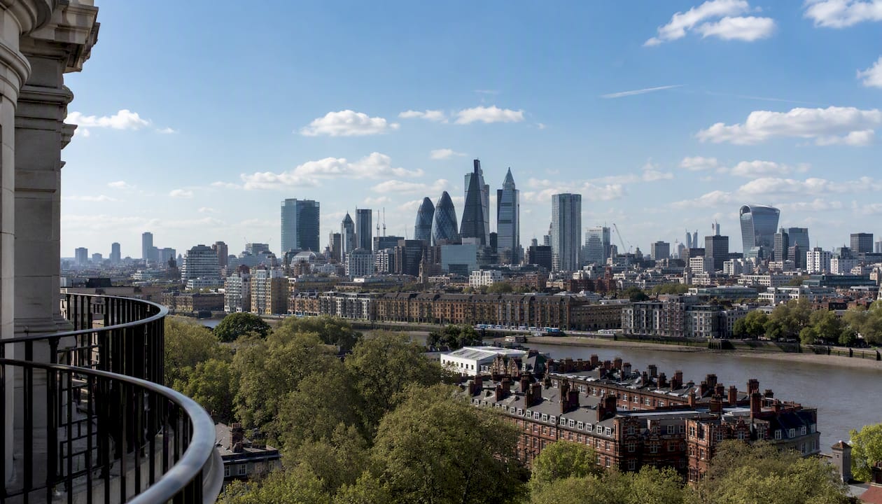
Applicants often underestimate how early this needs checking. Strategic viewing corridors aren’t confined to central London, and a tall building proposed several miles from a protected landmark can still trigger a full LVMF assessment if it sits within an identified background or foreground consultation area.
The Landscape Institute’s GLVIA-aligned guidance reinforces this by framing visualisation as technical evidence submitted alongside a Landscape and Visual Impact Assessment, rather than an illustrative add-on. Planning officers and their consultants read AVRs the way a structural engineer reads a load calculation: looking for the workings, not just the conclusion.
Certain project types almost always need verified views in London:
- Tall buildings over the borough’s local plan threshold, typically anything above 30 metres in most inner boroughs.
- Schemes within or adjacent to a designated LVMF viewing corridor or protected silhouette.
- Developments visible from royal parks, World Heritage Sites, or conservation area boundaries.
- Any proposal that a heritage consultee (Historic England, for example) has flagged as potentially affecting a skyline.
Public parks and elevated public realm also generate frequent requests. A scheme visible from Alexandra Palace or Greenwich Park can attract as much scrutiny as one sitting directly inside a formally designated corridor, because officers assess cumulative skyline change, not just individual protected sightlines.
How are planning-ready verified views actually produced?
The process runs in five distinct stages, and skipping any one of them is usually what causes an LPA to query a submission or request resubmission.
- Pre-production and briefing. The studio reviews the LPA’s specific requirements, checks whether the site falls within an LVMF corridor, and agrees viewpoint locations with the planning consultant, ideally referencing any pre-application advice already received.
- On-site survey. A control survey establishes fixed reference points using GNSS or total station equipment, tying every future camera position to Ordnance Survey grid coordinates rather than an estimated spot on a map.
- Calibrated photography. Photographs are taken from the exact surveyed tripod height and position, with focal length, camera make and model, and exposure settings all logged as metadata, usually shot in RAW format for maximum post-production fidelity.
- 3D modelling and photomontage. The proposed building is modelled with its origin point matched precisely to the survey data, then composited into the photograph with sightlines and occlusion (what should sit in front of or behind existing structures) checked against the real geometry.
- Quality assurance. Scale bars, viewpoint metadata tables, and a written verification statement are added, and the image typically goes through a peer review before it’s signed off as submission-ready.
Seasonal timing can complicate the process more than most applicants expect. A protected view assessed in summer, when trees are in full leaf, can look completely different in winter once foliage drops, and some LPAs will ask for both conditions where a strategic corridor runs through parkland.
Pro Tip: Request your winter and summer viewpoint photography in the same commissioning round, even if you only need one for the initial submission. Going back for a second seasonal shoot months later adds real delay to a resubmission cycle.
What deliverables and technical specifications should you expect?
A planning pack built around verified views needs more than the final image. Officers and their consultants want to check the working, so the deliverable set typically includes:
| Deliverable | Purpose |
|---|---|
| Verified photomontage (AVR2/AVR3) | Primary visual evidence showing proposed development in context |
| Annotated viewpoint plan | Shows exact camera locations on an OS-referenced site plan |
| Viewpoint metadata table | Camera make/model, focal length, GNSS coordinates, date and time of capture |
| Scale bar overlay | Confirms the proposed structure’s dimensions read correctly at print or screen size |
| Verification statement | Signed statement from the surveyor or responsible professional confirming methodology |
| ZTV/ZVI mapping (where required) | Zone of Theoretical Visibility, used for large-scale or highly visible schemes |
File formats matter more than most non-specialists assume. Planning officers generally expect high-resolution TIFF or PNG files for the final montage, but many teams also request layered PSD files so a case officer can inspect individual elements if a query arises during committee review. Resolution below 300dpi at final print size is a common reason submissions get bounced back for clarification.
Presentation inside the planning pack should follow a consistent structure: a labelled viewpoint reference matching the site plan, the metadata table sitting alongside each image, and a brief statement of accuracy summarising the survey method used. A submission that buries this information in an appendix, rather than presenting it clearly against each viewpoint, invites exactly the kind of officer query that slows a determination down.
How long does the process take and what drives cost?
A single verified view, from initial site survey through to final signed-off montage, typically takes between two and four weeks depending on site access and the complexity of the proposed massing. Multi-view packages, common for tall building applications with five or more required viewpoints, tend to run longer, often six to ten weeks, because survey visits, seasonal photography and peer review compound across each viewpoint.
Several factors push cost and timeline up or down:
- The number of viewpoints required, since each one needs its own survey visit and photography session.
- Whether new survey control is needed or existing survey data from a previous phase can be reused.
- Site access and permissions, particularly for viewpoints on private land, elevated buildings, or restricted parkland.
- Seasonal requirements, where a corridor needs both summer and winter foliage conditions assessed.
- Model complexity, since a heavily articulated façade with varied materials takes longer to build accurately than a simple massing block.
Pro Tip: Ask for itemised pricing broken down by viewpoint, survey, modelling and QA stages rather than a single lump sum. It makes it far easier to spot where a competing quote has cut corners on survey work to undercut on price.
Discussing site access and any third-party permissions at the briefing stage, rather than once the survey team turns up, avoids the single most common cause of schedule slippage on London projects: discovering on the day that a rooftop viewpoint needs a landlord’s sign-off nobody arranged in advance.
What should you include when briefing a verified-views supplier?
A tight brief saves weeks. At minimum, hand your supplier a site plan with an Ordnance Survey grid reference, proposed viewpoint coordinates (or a request for the supplier to recommend them based on LVMF corridors), the proposed massing and materials, and any specific guidance already issued by the LPA or a heritage consultee.
Before you commission the work, a handful of direct questions will tell you quickly whether a supplier can deliver AVR2 or AVR3 standard evidence:
- What survey method will you use to establish the camera position, and can I see an example verification statement from a previous project?
- Will the deliverable include full viewpoint metadata: camera make and model, focal length, and GNSS coordinates?
- What AVR classification will this project be produced to, and does that match what our LPA typically expects?
- Who peer-reviews the final image before it’s signed off?
- Can you demonstrate previous work inside an LVMF corridor or on a comparable London borough scheme?
Watch for a few recurring red flags. A supplier who can’t point to survey evidence, who offers a montage without a metadata table, or who leans on stock photography rather than site-specific calibrated shots, is producing marketing imagery, not planning evidence. If they can’t explain their camera calibration process in plain terms, that’s usually a sign they haven’t done AVR2 or AVR3 work before, whatever the portfolio suggests.
What does a planning-ready verified view project look like in practice?
Visual Trick has worked on projects where the brief called for a mid-rise residential scheme sitting close to a protected foreground view. The approach followed the standard survey-first sequence: a control survey established camera positions to Ordnance Survey grid coordinates, calibrated photography captured the existing skyline in both seasonal conditions, and the 3D model was built to match the approved massing drawings exactly, with sightlines checked against existing structures for occlusion.
The deliverable set included annotated viewpoint plans, a full metadata table for each image, and a signed verification statement, packaged in a way that let the planning consultant present the evidence clearly at committee stage without officers needing to chase supporting detail separately.
A few trust markers worth checking when reviewing any studio’s track record for this kind of work:
- Years of studio experience working specifically on London planning submissions, not just general CGI marketing work.
- Sectors served, including residential, care and retirement developments, and mixed-use schemes with sensitive sightlines.
- Example deliverables that have actually been used inside London planning packs, not just rendered concept art.
Pro Tip: If a studio’s portfolio only shows finished marketing renders with no metadata, viewpoint plans or verification statements visible anywhere, ask directly whether they’ve delivered AVR2/AVR3 work before. A studio experienced in architectural CGI for London schemes will have these documents ready to share.
How do you choose the right verified-views provider?
Four criteria matter more than portfolio polish when selecting a supplier for a London application: demonstrable LVMF or London Plan experience, use of proper survey control rather than estimated camera positions, clarity of deliverables and metadata, and clear terms on professional indemnity and intellectual property.
Ask any shortlisted supplier for a sample build-sheet, the internal document showing how they’ve structured survey data, camera settings and modelling references on a previous project, along with a peer review statement confirming someone other than the original author checked the final output. Suppliers confident in their methodology will produce these without hesitation.
The right balance of these criteria shifts with project scale. A small residential extension rarely needs full AVR3 rigour, and an AVR1 or AVR2 montage with basic survey control is usually proportionate. A mid-scale scheme inside a borough’s tall building policy area typically needs AVR2 as standard. A major scheme touching an LVMF protected vista, particularly anything likely to face committee scrutiny or third-party objection, warrants AVR3 with full peer review and a signed verification statement, because the cost of a weak submission (delay, resubmission, or a refusal that could have been avoided) far outweighs the modest saving of skipping proper survey control.
How do you get a quick, planning-ready quote from Visual Trick?
To turn around an accurate quote quickly, send over your site plan, any available proposed drawings or massing models, your preferred or LPA-suggested viewpoints, and the relevant planning reference or borough contact if one exists. The more of this you have ready upfront, the faster a supplier can scope survey requirements and give you a genuinely itemised figure rather than a rough estimate.
In return, expect an itemised scope covering survey, photography, modelling and QA stages, a realistic timescale broken down by viewpoint, and clear terms covering deliverable ownership and any revision allowances. Most established studios will respond to a well-prepared brief within a few working days, with the detailed proposal following shortly after an initial scoping call to confirm viewpoint access and LPA requirements.
Verified views as planning evidence, not marketing polish
Too many developers still commission verified views the way they’d commission a hero shot for a sales brochure, chasing the most flattering angle rather than the angle an LPA actually needs assessed. That’s backwards. An AVR exists to answer a specific question a planning officer or objector might raise: does this building actually intrude on that protected sightline, at that scale, from that exact point? Treat it as evidence first and the marketing value tends to follow anyway, because a rigorously surveyed image usually looks more convincing than a stylised one.
The single change that saves the most time on a London application is submitting full viewpoint metadata with the first submission, not waiting for an officer to ask for it. A camera make and model, focal length, GNSS coordinates and a verification statement cost little to include upfront but routinely prevent the back-and-forth that stalls a determination by weeks. Studios that treat this as an afterthought are the ones whose clients end up resubmitting.
Get a planning-ready verified views quote from Visual Trick
Visual Trick produces survey-led, LVMF-aware verified views for London planning submissions, built to AVR2 and AVR3 standard rather than treated as an afterthought once the drawings are finished. That means survey control from the outset, calibrated photography, and photomontage work checked against the same GLVIA-aligned standards your planning consultant and the LPA will be measuring it against.

Working with a studio that understands London-specific requirements, rather than a general CGI supplier learning LVMF conventions on your project, reduces the risk of officer queries and resubmission delays. Visual Trick’s architectural visualisation service covers the full workflow from survey through to finished planning pack deliverables, and the team has produced imagery used directly inside London borough submissions.
To get a quote, send your site plan, proposed drawings, preferred viewpoints and any LPA reference you already have. If your project touches sensitive sightlines specifically, the architectural CGI London page has further examples of the studio’s approach to strategic view assessments.
Frequently asked questions
What’s the difference between a verified view and a standard CGI render?
A verified view is built from surveyed camera positions and calibrated photography, with metadata and a verification statement confirming the methodology. A standard CGI render has no such audit trail, which is why LPAs treat the two very differently.
Do all London planning applications need verified views?
No. Most only become necessary when a scheme sits within an LVMF corridor, exceeds a borough’s tall building threshold, or has been flagged by a heritage consultee as potentially affecting a protected skyline.
How much does a verified view cost in London?
Cost depends heavily on the number of viewpoints, whether new survey control is needed, and site access complexity. Itemised quotes broken down by survey, photography, modelling and QA stages give the clearest comparison between suppliers.
What is AVR classification and why does it matter?
AVR0 through AVR3 signals how rigorously a photomontage has been produced, from unverified sketches (AVR0) to fully surveyed, peer-reviewed evidence (AVR3). Most London LPAs expect at least AVR2 for anything touching a strategic view.
Can I use the same verified view survey data for future project phases?
Often yes, provided the viewpoint locations remain relevant and the survey control data is still valid. Reusing existing survey data typically reduces cost and turnaround on later phases of the same site.
